Typhoon Dolphin in a few hours will turn into a howling super typhoon with winds of a staggering 275-330 kph! Just yesterday it seemed it would mature at most into a category 4 hurricane, but favourable conditions will enable it to join the league of Haiyan, Kammuri, Vongfong, Hagupit and the recent Maysak. All in the West Pacific Ocean.
Luckily it has already departed from Guam and its track suggests it will not hit mainland Japan. It will swing north away from the Philippines. So except for small non-decrepit island in the Pacific, humans are safe from Dolphin's fury.
The Pacific Ocean seems to have turned into a factory manufacturing super storms. Something to think about.
++++++++++++++++++++++++++++++++++
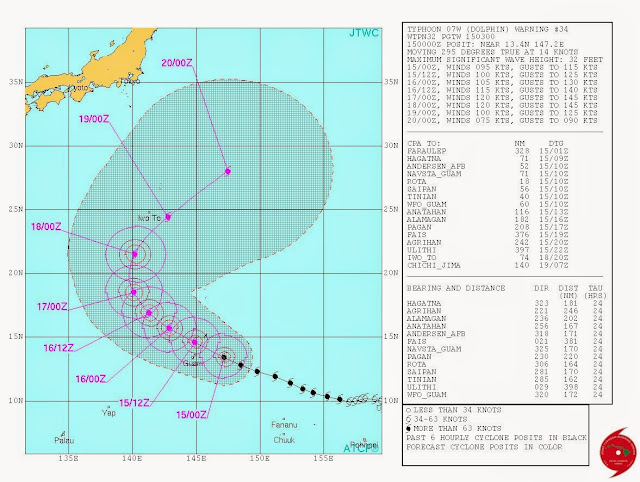
TYPHOON DOLPHIN NEARING GUAM NOW. UPDATE: MAY 15, 2015
Powerful typhoon Dolphin is nearing Guam now. Contrary to earlier predictions it will not turn out to be a super typhoon but Guam can expect sustained winds of 150+ kph. The good news for the island is the storm will pass slightly north of it , not a direct hit.
++++++++++++++++++++++++++
TYPHOON DOLPHIN UPDATE MAY 14, 2015
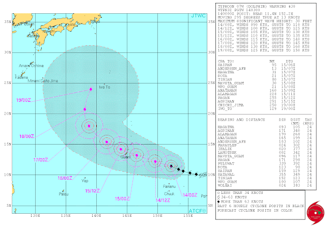
Typhoon Dolphin is on its way to becoming a super typhoon. The JTWC predicts that by May 18, 2015, it will turn into a howling monster with winds of 240+ kph.
Luckily for Guam Dolphin will turn into a super typhoon 3 days after it passes through the island. Guam is in for a direct hit on Friday evening (Local time) with wind speeds of 200+ kph, gusts up to 240 kph.
Philippines will remain safe from typhoon Dolphin as after passing Guam it will swing north. It is at that stage it will reach super typhoon status.
Japan will not be affected by the typhoon as it will continue curving away from the mainland. The Japanese historical island of Iwo Jima is for a direct hit with winds of 230 kph on May 19, 2015
One wonders why the Pacific Ocean is churning out super typhoons by the fistful whereas the Atlantic Ocean has become relatively docile. An interesting topic for weather scientists and climatologists.
Some meteorologists believe an over active Pacific Ocean is stifling cyclone development in the North Indian Ocean.
 |
| LATEST TRACK FORECAST (0300 GMT MAY 14, 2015) FOR TYPHOON DOLPHIN |
++++++++++++++++++++++++++++++++++
Another powerful typhoon is brewing in the Western Pacific Ocean after Noul is fading into oblivion. Typhoon Dolphin has already formed and is intensifying all the time.
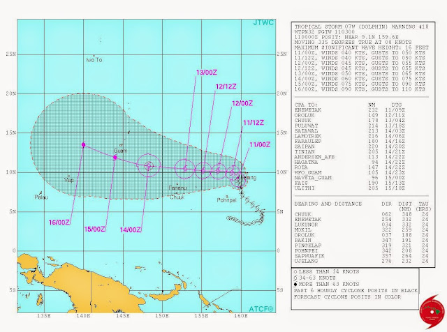
Dolphin will be as powerful as Noul was. But the good news for Philippines is that it is not going to hit it.
Guam is not going to be so lucky. Typhoon Dolphin will hit it directly on May 15, 2015 with sustained winds of 150 kph.
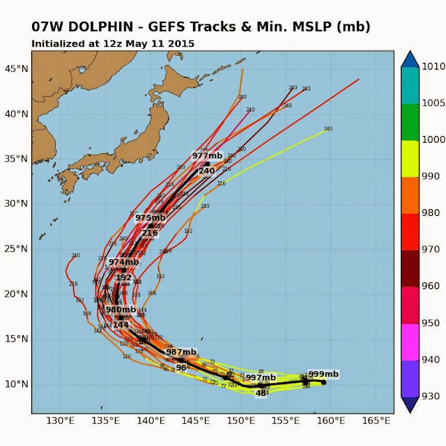
After that typhoon Dolphin will swing north, away from Philippines. It is not expected to affect Japan either.
 |
| TRACK FORECAST FOR TYPHOON DOLPHIN ACCORDING TO THE GFS ENSEMBLE MODEL |
 |
| TRACK FORECAST OF TYPHOON DOLPHIN BY JTWC |


No comments:
Post a Comment